Blog 7
Day 5
23 May
Camping location: 18.72296 S; 12.30992 E, 4km south of the Hoarusib River mouth
56km
Another delightfully foggy morning meant no significant wind. The tide was in though and so for the first 15km I struggled in the soft beach sand. Then, in search of a better surface, I discovered that across the storm surge barrier of sea debris was a gravelly, sandy plain. I followed the line of the single vehicle track that ran parallel to the beach, never more than a couple of hundred metres from the shore. The wheel ruts weren’t great to cycle in as they were either heavily corrugated or deep sand, but the plains, with varying degrees of softness were the best option.
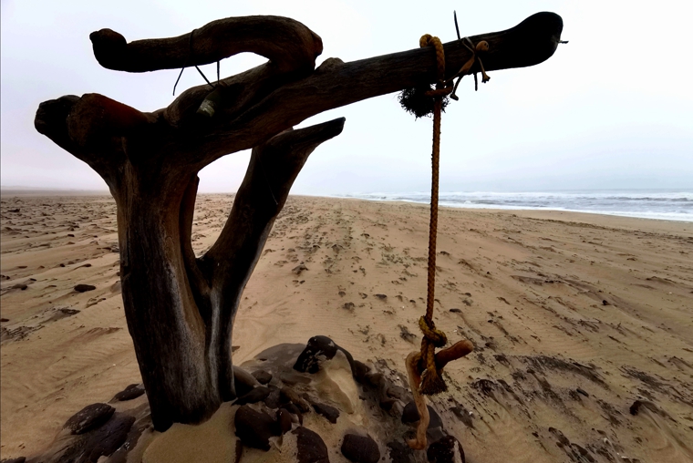
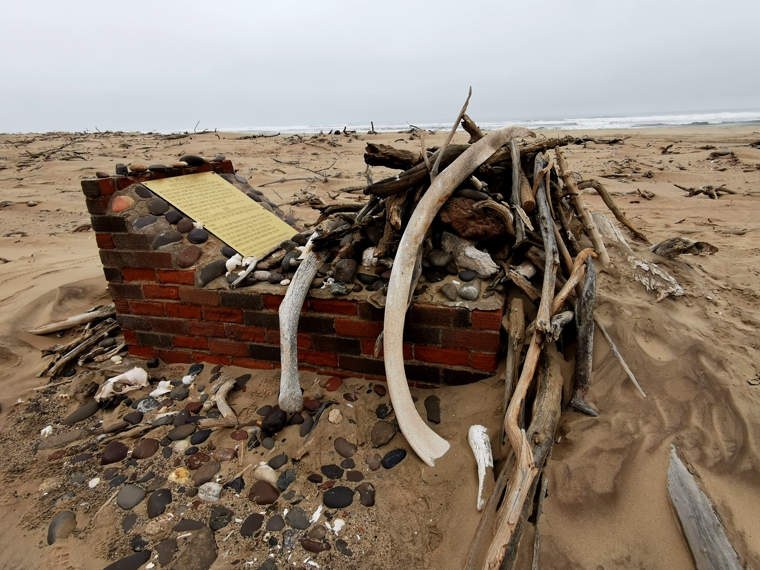
After 32km, we came across Matthias Koraseb’s grave. He and Angus Campbell Macintyre were to only two casualties of the Dunedin Star disaster. They were the crew from the tug boat, Charles Elliott, that was sent from Walvis Bay on news of the grounding of the Dunedin Star to assist in the rescue of crew and passengers. The boat was ill-prepared with no radio communications, and when it finally reached the stricken Dunedin Star, it could do little to help in the treacherous seas. It was running out of coal and on the return journey to Walvis Bay, ran aground about 600 yards from shore. Macintyre’s body was never found; Matthias made it to shore with some other crew members but died soon after.
From there I climbed into the sand dunes as I approached the Khurib River mouth, then cycled through a spectacular little gorge that leads to the ocean. Rocky Point, a renowned fishing spot (for the very few who can reach this region with a permit.
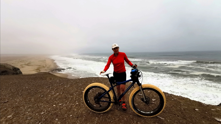
The aim of the day was to get to the south side of the Hoarusib River mouth, which I did after a long, slow sandy section. The river, like all of Namibia’s rivers between the Kunene and Orange, is ephemeral. Sixty kilometres upstream at Purros, we had enjoyed following a little stream through the canyon, spotting elephants and other wildlife, but near the sea, it was a vast swampy expanse. A small herd of springbok grazed on the green, grassy oasis, though we were on the lookout for some bigger game…hopefully not lions though. Elago stayed close to me on this section. We camped about 4km south of the river amongst the sand dunes, close to the beach.
Day 6
24 May
Mowe Bay: 19.37235 S; 12.70958 E
35km
Total Distance: 282km
It was difficult to get up today – the last five days of 7.5-8hours of cycling has been building. The aim was to do a shorter day to reach Mowe Bay where the intention is to take a day off. I had factored in a rest day for the first section to Swakopmund and this tiny settlement is really the only well-positioned opportunity to have a break. I need to let my body catch up. As it turned out, Day 6 was the most interesting day of the journey so far, with many interesting features to explore.
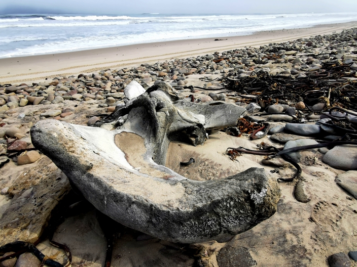
The final remnant of the Dunedin Star saga lay 5km south of our campsite. Pieces of the wreck of the Venturer bomber airplane were scattered amongst the beach debris, perhaps 50m from shore. The plane had been sent from Cape Town to drop supplies for the stricken survivors who were left stranded on the beach without water, food or shelter. The pilot decided he should land the plane to bring some women and young children to safety. However, he landed on a salt pan and bogged the plane. By the time he was able to free the wheels two days later, sand had got into the engine. On the return flight, all engines failed and he was forced to ditch in the sea. All on board survived, but it was yet another isolated group that needed to be rescued.
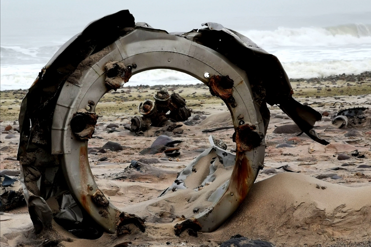
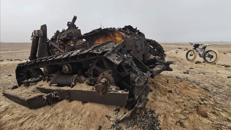
Six kilometres on from the Venturer wreck, I came across the rusting remnants of machinery from a failed diamond mining operation. In 1979/1980, some farmers from southern Namibia decided to try their luck at the diamond trade. Two years later the venture was abandoned. The harsh environment, isolation and excessive costs of equipping and running the outfit made the project untenable. Forty years on and all that remains is a rusted bulldozer, a tractor and an airstrip that had been marked out.
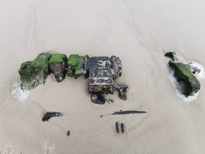
Back on the beach, 15km south of the failed diamond mine, lay the wreck of a small wooden fishing boat, the Karimuna, wrecked in 1971. Interestingly, wood tends to be better preserved than iron vessels that tend to oxidise faster with the wind, salt water and sand. Parts of the engine were made of copper and these, in contrast to the rest of the ship’s remains, appeared unaffected by the elements, embedded in the sand as if a crew member had just polished them.
Near to Mowe Bay lay entombed another wreck, that of the Suiderkus (Southern Cross), a larger fishing vessel that came to grief in 1974. This boat, made of iron, was decomposing fast with the heavy seas crashing on the rocks that would have been it’s downfall.
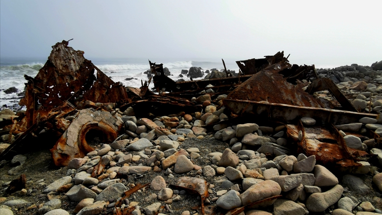
Mowe Bay is a tiny outpost settlement set high above the sea in a rocky hill. A day off the bike should give me a chance to rest, catch up on communications and to meet Philip Stander, the pre-eminent Desert Lion conservationist.


I long wished to hike along this coast, towing a cart…. now I don’t have to, as I can enjoy your journey vicariously Kate! =) Thanks! Amazing place with lots of history hey!
I had no idea of how much history there is along this coast!
Loving the stories and trying to imagine the challenges you’re overcoming. The closest thing I could come up with was pushing Nina in her pushchair with Jim on my back at the beach 🙂 BW from the 4 of us at TCH
Excellent reporting Kate and your photos are fantastic..
Keep peddling as I know you will..
Awesome trip Kate. really enjoying the blogs and your photos.